
文件:Tibet provinces.png
Ê̤ṳ-lāng chék-cháung:800 × 555 chiông-só. Gì-tă hŭng-biêng-lŭk: 320 × 222 chiông-só | 640 × 444 chiông-só | 1,024 × 711 chiông-só | 1,421 × 986 chiông-só.
Nguòng-dā̤ gì ùng-giông (1,421 × 986 chiông-só, ùng-giông duâi-nâung: 871 KB,MIME lôi-hìng: image/png)
| Mièu-sŭk |
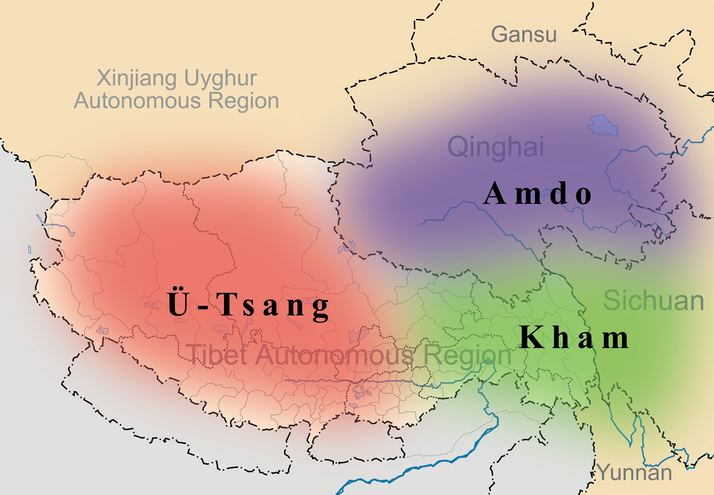
English: A simple map of the three traditional provinces of Tibet overlaid on a map of modern provincial boundaries of the People's Republic of China. |
| Nĭk-gĭ | (UTC) |
| Lài-nguòng | |
| Cáuk-ciā |
|
| 這是一張修飾過的圖片,即本圖片是用軟體修改過後的版本,修改的方式或內容有:added traditional provinces overlay。原版圖片來源:Map of Tibet Ü-Tsang Amdo and Kham.jpg。修改者:Kmusser。
|
此檔案採用創用CC 姓名標示-相同方式分享 3.0 未在地化版本授權條款。
- Nṳ̄ â̤-sāi cê̤ṳ-iù:
- hŭng-hiōng – Hók-cié, huák-buó, diòng-bó̤ buōng cáuk-pīng
- tṳ̀ng-sĭng siŭ-gāi – gāi-biĕng cáuk-pīng
- Nâ diŏh áng ī-hâ gì dèu-giông:
- biĕu-sê miàng-sáng – 您必須指名出正確的製作者,和提供授權條款的連結,以及表示是否有對內容上做出變更。您可以用任何合理的方式來行動,但不得以任何方式表明授權條款是對您許可或是由您所使用。
- dùng-iông huŏng-sék hŭng-hiōng – Lí nā kái-tōng, piàn-khoán, he̍k-chiá kun-kù pún chok chhòng-chō, lí kaⁿ-taⁿ ē-tàng ēng kap pún chok kâng-khoán he̍k-chiá saⁿ-chhiūⁿ ê hí-khó lâi hoat-pò͘ chò--chhut-lâi ê chok-phín.
原始上傳日誌
This image is a derivative work of the following images:
- File:Tibet&neighbors_Locator_map.svg licensed with Cc-by-sa-3.0, GFDL
- 2009-10-13T22:22:54Z Keithonearth 1520x1059 (188220 Bytes) {{Information |Description={{en|1=A simple map of the Tibetan Autonomous Region, and surrounding Nations, and States. It was made for [[:en:Template:Location map China Tibet]].}} |Source={{own}} |Author=[[User:Keithonearth|K
- File:Map_of_Tibet_Ü-Tsang_Amdo_and_Kham.jpg licensed with Cc-by-sa-2.5
Uploaded with derivativeFX
Ùng-giông lĭk-sṳ̄
Sōng-dĕk siŏh bĭk nĭk-gĭ/sì-găng lì káng hiā sèng-hâiu gì ùng-giông.
| Nĭk-gĭ/Sì-găng | Sáuk-liŏk-dù | Chióh-cháung | Ê̤ṳng-hô | Suók-mìng | |
|---|---|---|---|---|---|
| hiêng-káik-sì | 2011 nièng 3 nguŏk 27 hô̤ (LB) 21:35 | | 1,421 × 986(871 KB) | Kmusser | {{Information |Description={{en|1=A simple map of the three traditional provinces of Tibet overlaid on a map of modern provincial boundaries of the People's Republic of China.}} == |Source=*File:Tibet&neighbors_Locator_map.svg *[[:File:Map_of_Tibet_ |
Lièng-giék
Â-dā̤ gì hiĕk-miêng lièng gáu ciā ùng-giông:
Cuòng-mĭk ùng-giông sāi-ê̤ṳng cìng-huóng
Â-dā̤ gì gì-tă wiki găk lā̤ sāi cī-bĭh ùng-giông:
- ast.wikipedia.org gì sāi-ê̤ṳng cìng-huóng
- bg.wikipedia.org gì sāi-ê̤ṳng cìng-huóng
- bn.wikipedia.org gì sāi-ê̤ṳng cìng-huóng
- cs.wikipedia.org gì sāi-ê̤ṳng cìng-huóng
- da.wikipedia.org gì sāi-ê̤ṳng cìng-huóng
- de.wikipedia.org gì sāi-ê̤ṳng cìng-huóng
- diq.wikipedia.org gì sāi-ê̤ṳng cìng-huóng
- en.wikipedia.org gì sāi-ê̤ṳng cìng-huóng
- en.wikivoyage.org gì sāi-ê̤ṳng cìng-huóng
- en.wiktionary.org gì sāi-ê̤ṳng cìng-huóng
- eo.wikipedia.org gì sāi-ê̤ṳng cìng-huóng
- es.wikipedia.org gì sāi-ê̤ṳng cìng-huóng
- et.wikipedia.org gì sāi-ê̤ṳng cìng-huóng
- eu.wikipedia.org gì sāi-ê̤ṳng cìng-huóng
- fa.wikipedia.org gì sāi-ê̤ṳng cìng-huóng
- fr.wikipedia.org gì sāi-ê̤ṳng cìng-huóng
- fr.wiktionary.org gì sāi-ê̤ṳng cìng-huóng
- ga.wikipedia.org gì sāi-ê̤ṳng cìng-huóng
- hi.wikipedia.org gì sāi-ê̤ṳng cìng-huóng
- hu.wikipedia.org gì sāi-ê̤ṳng cìng-huóng
檢視此檔案的更多全域使用狀況。