
文件:Map of Kentucky highlighting Lee County.svg

此 SVG 檔案的 PNG 預覽的大小:800 × 345 chiông-só。 Gì-tă hŭng-biêng-lŭk: 320 × 138 chiông-só | 640 × 276 chiông-só | 1,024 × 441 chiông-só | 1,280 × 551 chiông-só | 2,560 × 1,103 chiông-só | 6,770 × 2,916 chiông-só.
Nguòng-dā̤ gì ùng-giông (SVG ùng-giông, chék-cháung: 6,770 × 2,916 chuông-só, ùng-giông duâi-nâung:127 KB)
總結
| Mièu-sŭk |
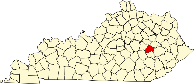
English: This is a locator map showing Lee County in Kentucky. For more information, see Commons:United States county locator maps. |
| Nĭk-gĭ | |
| Lài-nguòng |
Cê-gă cáuk-pīng: English: The maps use data from nationalatlas.gov, specifically countyp020.tar.gz on the Raw Data Download page. The maps also use state outline data from statesp020.tar.gz. The Florida maps use hydrogm020.tar.gz to display Lake Okeechobee. |
| Cáuk-ciā | David Benbennick |
版權說明
| 我,此作品的版權所有人,釋出此作品至公共領域。此授權條款在全世界均適用。 這可能在某些國家不合法,如果是的話: 我授予任何人有權利使用此作品於任何用途,除受法律約束外,不受任何限制。 |
Ùng-giông lĭk-sṳ̄
Sōng-dĕk siŏh bĭk nĭk-gĭ/sì-găng lì káng hiā sèng-hâiu gì ùng-giông.
| Nĭk-gĭ/Sì-găng | Sáuk-liŏk-dù | Chióh-cháung | Ê̤ṳng-hô | Suók-mìng | |
|---|---|---|---|---|---|
| hiêng-káik-sì | 2006 nièng 2 nguŏk 12 hô̤ (LB) 12:22 | | 6,770 × 2,916(127 KB) | David Benbennick | {{subst:User:Dbenbenn/clm|county=Lee County|state=Kentucky}} |
Lièng-giék
Â-dā̤ gì hiĕk-miêng lièng gáu ciā ùng-giông:
Cuòng-mĭk ùng-giông sāi-ê̤ṳng cìng-huóng
Â-dā̤ gì gì-tă wiki găk lā̤ sāi cī-bĭh ùng-giông:
- ar.wikipedia.org gì sāi-ê̤ṳng cìng-huóng
- bg.wikipedia.org gì sāi-ê̤ṳng cìng-huóng
- bpy.wikipedia.org gì sāi-ê̤ṳng cìng-huóng
- ceb.wikipedia.org gì sāi-ê̤ṳng cìng-huóng
- ce.wikipedia.org gì sāi-ê̤ṳng cìng-huóng
- cs.wikipedia.org gì sāi-ê̤ṳng cìng-huóng
- cy.wikipedia.org gì sāi-ê̤ṳng cìng-huóng
- de.wikipedia.org gì sāi-ê̤ṳng cìng-huóng
- en.wikipedia.org gì sāi-ê̤ṳng cìng-huóng
- Lee County, Kentucky
- Beattyville, Kentucky
- North Fork Kentucky River
- Middle Fork Kentucky River
- List of counties in Kentucky
- Eastern Kentucky Coalfield
- Template:Lee County, Kentucky
- Athol, Kentucky
- Heidelberg, Kentucky
- Saint Helens, Kentucky
- Zoe, Kentucky
- Proctor, Kentucky
- User:Nyttend/County templates/KY/2
- National Register of Historic Places listings in Lee County, Kentucky
- Category:Populated places in Lee County, Kentucky
- Williba, Kentucky
- White Ash, Kentucky
- Idamay, Kentucky
- Airedale, Kentucky
- Leeco, Kentucky
- Enoch, Kentucky
- Zacharia, Kentucky
- Primrose, Kentucky
- Tallega, Kentucky
- Fillmore, Kentucky
- Willow Shoals, Lee County, Kentucky
- Fixer, Kentucky
- Yellow Rock, Kentucky
- Fincastle, Lee County, Kentucky
- Greeley, Kentucky
- Belle Point, Kentucky
- Canyon Falls, Kentucky
- Congleton, Lee County, Kentucky
- Cressmont, Kentucky
- Delvinta, Kentucky
- Earnestville, Kentucky
- Old Landing, Kentucky
- Lower Buffalo, Kentucky
- Mount Olive, Kentucky
- Maloney, Kentucky
檢視此檔案的更多全域使用狀況。