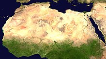
文件:Africa satellite plane.jpg

Ê̤ṳ-lāng chék-cháung:570 × 600 chiông-só. Gì-tă hŭng-biêng-lŭk: 228 × 240 chiông-só | 456 × 480 chiông-só | 730 × 768 chiông-só | 973 × 1,024 chiông-só | 1,947 × 2,048 chiông-só | 8,460 × 8,900 chiông-só.
Nguòng-dā̤ gì ùng-giông (8,460 × 8,900 chiông-só, ùng-giông duâi-nâung: 7.34 MB,MIME lôi-hìng: image/jpeg)
Ùng-giông lĭk-sṳ̄
Sōng-dĕk siŏh bĭk nĭk-gĭ/sì-găng lì káng hiā sèng-hâiu gì ùng-giông.
| Nĭk-gĭ/Sì-găng | Sáuk-liŏk-dù | Chióh-cháung | Ê̤ṳng-hô | Suók-mìng | |
|---|---|---|---|---|---|
| hiêng-káik-sì | 2005 nièng 3 nguŏk 28 hô̤ (B1) 00:46 |  | 8,460 × 8,900(7.34 MB) | Dbenbenn | original high-resolution version, cropped land_shallow_topo_west.tif at 8460x8900+19400+6200 |
| 2004 nièng 11 nguŏk 13 hô̤ (B6) 21:08 |  | 741 × 800(113 KB) | Bjarki S |
Lièng-giék
Â-dā̤ gì hiĕk-miêng lièng gáu ciā ùng-giông:
Cuòng-mĭk ùng-giông sāi-ê̤ṳng cìng-huóng
Â-dā̤ gì gì-tă wiki găk lā̤ sāi cī-bĭh ùng-giông:
- ace.wikipedia.org gì sāi-ê̤ṳng cìng-huóng
- af.wikipedia.org gì sāi-ê̤ṳng cìng-huóng
- als.wikipedia.org gì sāi-ê̤ṳng cìng-huóng
- ar.wikipedia.org gì sāi-ê̤ṳng cìng-huóng
- ar.wikinews.org gì sāi-ê̤ṳng cìng-huóng
- ast.wikipedia.org gì sāi-ê̤ṳng cìng-huóng
- azb.wikipedia.org gì sāi-ê̤ṳng cìng-huóng
- az.wikipedia.org gì sāi-ê̤ṳng cìng-huóng
- az.wikiquote.org gì sāi-ê̤ṳng cìng-huóng
- ba.wikipedia.org gì sāi-ê̤ṳng cìng-huóng
- be.wikipedia.org gì sāi-ê̤ṳng cìng-huóng
- bm.wikipedia.org gì sāi-ê̤ṳng cìng-huóng
- ca.wikiquote.org gì sāi-ê̤ṳng cìng-huóng
- co.wikipedia.org gì sāi-ê̤ṳng cìng-huóng
- cv.wikipedia.org gì sāi-ê̤ṳng cìng-huóng
- da.wikipedia.org gì sāi-ê̤ṳng cìng-huóng
- de.wikipedia.org gì sāi-ê̤ṳng cìng-huóng
- Oldowan
- CFA-Franc-Zone
- Fußball in Südafrika
- Portal:Afrika
- Wikipedia:Archiv/Qualitätsoffensive/Afrika
- Wikipedia:WikiProjekt Afrika
- Wikipedia Diskussion:WikiProjekt Afrika
- Uganda Olympic Committee
- Wikipedia:WikiProjekt Sudan
- Portal:Afrika/Unsere besten Artikel
- Wikipedia:WikiProjekt Äthiopien
- Portal:Gambia
- Fußball in Äthiopien
- Wikipedia:WikiProjekt Sudan/Verwandte
- Portal:Afrika/Register
- Benutzer:Vorlage/Herkunftsvorlagen
- Portal:Hip-Hop
- Portal:Hip-Hop/Hip-Hop nach Ländern
- Namibia National Olympic Committee
- Fußball
- Benutzer:Heiteck
- Benutzer:Vorlage/aus Afrika
- Gambia National Olympic Committee
- Portal:Nigeria
- Fußball in Lesotho
- Fußball in Burkina Faso
- Benutzer:Kuemmjen/Länderliste
檢視此檔案的更多全域使用狀況。


