
文件:City of London skyline from London City Hall - Oct 2008.jpg

Ê̤ṳ-lāng chék-cháung:800 × 420 chiông-só. Gì-tă hŭng-biêng-lŭk: 320 × 168 chiông-só | 640 × 336 chiông-só | 1,024 × 537 chiông-só | 1,280 × 671 chiông-só | 2,560 × 1,343 chiông-só | 8,441 × 4,427 chiông-só.
Nguòng-dā̤ gì ùng-giông (8,441 × 4,427 chiông-só, ùng-giông duâi-nâung: 10.81 MB,MIME lôi-hìng: image/jpeg)
總結
| Mièu-sŭk |
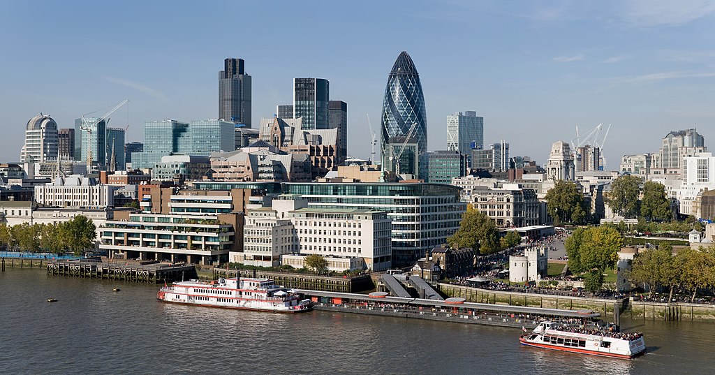
English: The City of London skyline as viewed toward the north-west from the top floor viewing platform of London City Hall on the southern side of the Thames. In the foreground: Dixie Queen and Millennium Time at Tower Millennium Pier. This is a 5 segment panoramic image taken by myself with a Canon 5D and 24-105mm f/4L IS lens. |
| Nĭk-gĭ | |
| Lài-nguòng | Cê-gă cáuk-pīng |
| Cáuk-ciā | Diliff |
| Sêu-guòng hṳ̄-kō̤ (Bô siŏh-huòi sāi ciā ùng-giông) |
Summary:In using this image or any subsequent derivatives of it, you are required to release the image under the same license. As such, any reproduction of this image, in any medium, must appear with a copy of, or full URL of the license.Attribution of this image to the author (DAVID ILIFF) is also required, preferably in a prominent location near the image.No other conditions may be added to, or removed from this license without the permission of the author and copyright holder.Suggested attribution: "Photo by DAVID ILIFF. License: CC BY-SA 3.0"Please review the full license requirements carefully before using this image. If you would like to clarify the terms of the license or negotiate less restrictive commercial licensing outside of the bounds of GFDL/CC-BY-SA, please contact me by email, or if you don't have a Wikipedia account you can either leave a message on my talk page with your contact details and your request, or you can contact me on Facebook. Please also send a 'friend request' to ensure that I am aware of your message. |
| 其他版本 |
  |
| 拍攝地點 | | 位於此地的本圖片與其他圖片: OpenStreetMap |
|---|
版權說明
我,本作品的著作權持有者,決定用以下授權條款發佈本作品:
此檔案採用創用CC 姓名標示-相同方式分享 3.0 未在地化版本授權條款。
- Nṳ̄ â̤-sāi cê̤ṳ-iù:
- hŭng-hiōng – Hók-cié, huák-buó, diòng-bó̤ buōng cáuk-pīng
- tṳ̀ng-sĭng siŭ-gāi – gāi-biĕng cáuk-pīng
- Nâ diŏh áng ī-hâ gì dèu-giông:
- biĕu-sê miàng-sáng – 您必須指名出正確的製作者,和提供授權條款的連結,以及表示是否有對內容上做出變更。您可以用任何合理的方式來行動,但不得以任何方式表明授權條款是對您許可或是由您所使用。
- dùng-iông huŏng-sék hŭng-hiōng – Lí nā kái-tōng, piàn-khoán, he̍k-chiá kun-kù pún chok chhòng-chō, lí kaⁿ-taⁿ ē-tàng ēng kap pún chok kâng-khoán he̍k-chiá saⁿ-chhiūⁿ ê hí-khó lâi hoat-pò͘ chò--chhut-lâi ê chok-phín.

|
已授權您依據自由軟體基金會發行的無固定段落、封面文字和封底文字GNU自由文件授權條款1.2版或任意後續版本,對本檔進行複製、傳播和/或修改。該協議的副本列在GNU自由文件授權條款中。 |
Nṳ̄ buóh dĭk sié-nó̤h sêu-guòng dèu-kuāng dŭ kō̤-ī gēng.
評價
|
|
|
| Annotations | This image is annotated: View the annotations at Commons |
Ùng-giông lĭk-sṳ̄
Sōng-dĕk siŏh bĭk nĭk-gĭ/sì-găng lì káng hiā sèng-hâiu gì ùng-giông.
| Nĭk-gĭ/Sì-găng | Sáuk-liŏk-dù | Chióh-cháung | Ê̤ṳng-hô | Suók-mìng | |
|---|---|---|---|---|---|
| hiêng-káik-sì | 2012 nièng 6 nguŏk 24 hô̤ (LB) 07:41 | | 8,441 × 4,427(10.81 MB) | Tim! | Reverted to version as of 12:54, 12 October 2008 |
| 2008 nièng 10 nguŏk 12 hô̤ (LB) 12:54 |  | 8,441 × 4,427(10.81 MB) | Diliff | {{Information |Description={{en|1=The City of London skyline as viewed toward the north-west from the top floor viewing platform of London City Hall on the southern side of the Thames. This is a 5 segment panoramic image taken by myself with a Canon 5D an |
Lièng-giék
Mò̤ hiĕk-miêng lièng gáu ciā ùng-giông.
Cuòng-mĭk ùng-giông sāi-ê̤ṳng cìng-huóng
Â-dā̤ gì gì-tă wiki găk lā̤ sāi cī-bĭh ùng-giông:
- af.wikipedia.org gì sāi-ê̤ṳng cìng-huóng
- ar.wikipedia.org gì sāi-ê̤ṳng cìng-huóng
- az.wikipedia.org gì sāi-ê̤ṳng cìng-huóng
- az.wiktionary.org gì sāi-ê̤ṳng cìng-huóng
- be-tarask.wikipedia.org gì sāi-ê̤ṳng cìng-huóng
- be.wikipedia.org gì sāi-ê̤ṳng cìng-huóng
- bg.wikipedia.org gì sāi-ê̤ṳng cìng-huóng
- bs.wikipedia.org gì sāi-ê̤ṳng cìng-huóng
- ca.wikipedia.org gì sāi-ê̤ṳng cìng-huóng
- cy.wikipedia.org gì sāi-ê̤ṳng cìng-huóng
- de.wikipedia.org gì sāi-ê̤ṳng cìng-huóng
- en.wikipedia.org gì sāi-ê̤ṳng cìng-huóng
- Tower Millennium Pier
- Wikipedia:WikiProject UK geography
- Wikipedia talk:WikiProject UK geography
- User:Diliff
- Portal:London/Pictures/Wikipedia featured pictures
- Wikipedia:Featured pictures/Places/Panorama
- Portal:United Kingdom/Featured picture
- Wikipedia:WikiProject UK geography/Announcements
- Wikipedia:Featured pictures thumbs/13
- Metropolis
- Wikipedia:Featured picture candidates/October-2008
- Wikipedia:Featured picture candidates/City of London skyline
- Wikipedia:Wikipedia Signpost/2008-11-08/Features and admins
- Wikipedia:Wikipedia Signpost/2008-11-08/SPV
- Wikipedia:Picture of the day/June 2009
- Template:POTD/2009-06-08
- User talk:Diliff/Archive6
- List of central business districts
- Wake Up to Money
- User:Quibik/Montage
- Portal:London/Featured picture
- Portal:London/Featured picture/12
- User talk:Sabrebd/Autoarchive 4
- Talk:United Kingdom/Archive 27
- User talk:Ottoniel B
- Portal:United Kingdom/Featured picture/47
- Talk:London/Archive 11
- Template:User Part Time Resident-London
- User:DexDor/Categorization
檢視此檔案的更多全域使用狀況。